
China’s moves in disputed waters spark concerns in Japan about ‘incremental control’
China could gain control of more undersea resources, change status quo with suspected construction of new offshore platform, analysts say
Japan has lodged a protest with Beijing over the suspected construction of a new offshore platform in disputed waters of the East China Sea – a development that analysts say could signal China’s latest attempt to extend administrative control through incremental moves.
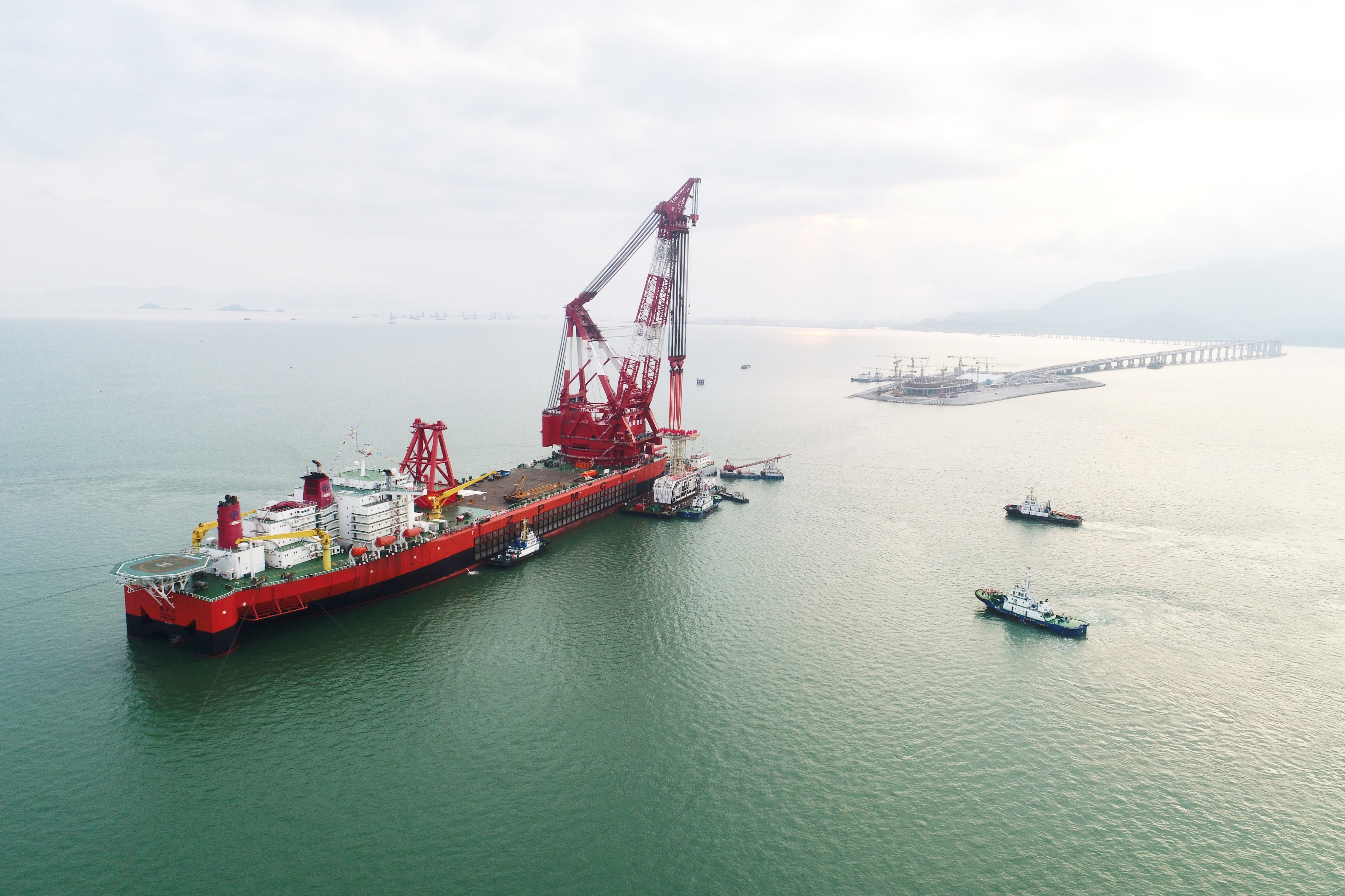
The protest came after satellite imagery showed two large Chinese ships positioned roughly 345km northwest of Kume Island in Okinawa prefecture – an area where the countries’ exclusive economic zones (EEZs) overlap and remain subject to a long-running maritime dispute.
The images, released by the European Space Agency and analysed alongside data from the international Automatic Identification System, identified the vessels as the 297-metre crane ship Zhenhua 30 and the 160-metre heavy-lift ship Debo 3.
Both ships have remained in the same location since May 11, according to Japanese newspaper Sankei Shimbun, supported by a flotilla of supply ships and tugboats. Japan’s coastguard has reported that the activity appears linked to the construction of an “offshore platform”.
Tokyo lodged a formal complaint through China’s embassy in Japan, citing the platform’s location within overlapping EEZ claims and warning against unilateral actions that could alter the status quo.
At the heart of the dispute is disagreement over how to draw the maritime boundary. Japan maintains the line should be based on the equidistant principle, or median line, between the countries’ coastlines. China argues for a boundary that reflects its extended continental shelf – a method that would push the line eastward and give it control of more undersea resources.
The two sides had reached a tentative agreement in 2008 to work together to extract any natural resources that lie beneath the seabed in the disputed area, but that was put on hold when relations worsened over the question of the sovereignty of the Diaoyu Islands. Beijing claims the archipelago, known in Japan as the Senkakus, which are to the south of the structure that is being erected.
And while Japan has not conducted exploration and extraction of resources, China is apparently making unilateral moves to exploit the gas and oil deposits. Tokyo is concerned that resources extracted on the Chinese side of the line may actually be coming from deposits in the Japanese sector.
A bigger concern, analysts point out, is Beijing assuming “incremental control” of more territory.
“It appears the Chinese want to extract resources and it is very likely they also want to carry out scientific research, but what they really want to do is to expand the area over which they carry out their own law enforcement activities,” said Masayuki Masuda, director of Chinese studies at the National Institute for Defence Studies in Tokyo.
“China is trying to claim administrative control over this area, even though it is disputed and no agreement on the median line has been reached,” he told This Week in Asia. “Japan’s position is that the status quo cannot be unilaterally changed, but enforcement is extremely difficult in this area.”

To underline the growing Chinese presence in the region, the Japan coastguard reported on Wednesday that four Chinese coastguard vessels entered Japanese territorial waters around the Diaoyu Islands the same day.
Ben Ascione, an assistant professor of international relations at Tokyo’s Waseda University, said Beijing’s tactics were reminiscent of how Chinese forces took over uninhabited islands and reefs in the South China Sea and eventually turned many of them into military bases.
“This appears to be an incrementalist approach to changing the status quo and the Chinese are testing the size of the Japanese reaction,” he said. “And if there is no reaction, then it seems likely that they will continue to take greater incremental control.”
The challenge for Japan is to make it clear that China is going beyond reasonable behaviour at the same time as not escalating the situation, according to Ascione.
“If Japan mimicked China’s tactics and put a structure on the Japanese side of the median line, that would give legitimacy to the Chinese,” he said. “But if Tokyo does nothing, it runs the risk of losing out on natural resources at the same time as failing to resist the incremental loss of control [of ocean territory].”
Japan will be keeping a close eye on developments in the Yellow Sea, where South Korea is also using the construction of facilities to expand its territorial claims where the two countries’ EEZs overlap, according to Ascione. In April, Seoul expressed “deep concern” over a series of structures that are being built in the disputed area.
China has claimed that a decommissioned French oil rig it has installed in the Provisional Measures Zone of the Yellow Sea is a “fish farm support facility”. Seoul believes the rig – which includes a helicopter landing pad – is effectively an artificial island designed to reinforce Beijing’s territorial claims.
The situation is complicated by talks on the median line and confirmation of the two sides’ territories being on hold, while China in 2010 unilaterally declared the area to be its “internal waters”.
 being blocked by three Vietnamese coastguard vessels near China’s oil drilling rig in disputed waters in the South China Sea in May 2014. Photo: AFP")
Deployment of the repurposed facility has echoes of China siting an oil rig within Vietnam’s EEZ in 2014 and using it to expand its control over a large part of the South China Sea and the Paracel Islands. Known as the Hai Yang Shi You 981 stand-off, after the name of the rig, the Vietnamese responded decisively and the Chinese withdrew after two months, claiming their research had been completed early.
Japan is also concerned about the disappearance of some of the hundreds of tiny islands that make up the archipelago and are used to claim the nation’s territorial waters. Erosion, changing currents and rising tides have all affected some of the smallest islands, with at least two such islets disappearing beneath the waves in recent years.
The government has this month announced plans to carry out laser-based surveys of remote border islands to determine any changes in their size, and step up measures to protect them.
Aerial surveys will be conducted every five years, the government has decided, instead of ground surveys once a decade. Authorities say that 25 islands are particularly susceptible to erosion and may be reinforced.